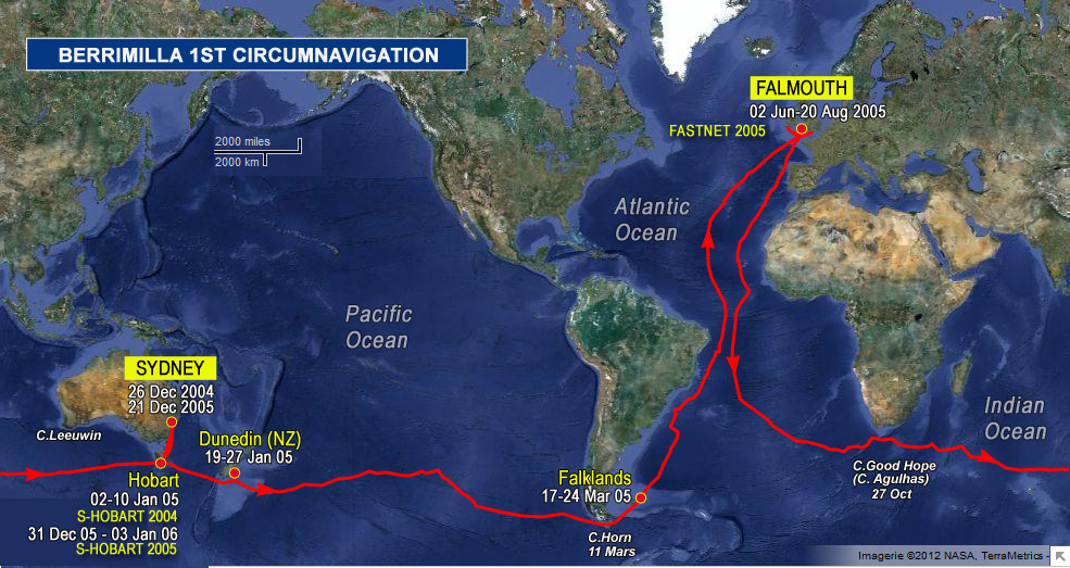
A little burst on milestones and where we hope to go. The Admiralty publication Ocean Passages for the World NP 136 5th ed @ pp 219-221 shows the southern route waypoints for the south pacific. We have 82 miles to go to the Snares, the first of these and our first big milestone because it ticks off the Tasman sea and NZ. Then we head for waypoint A at 4830S 16500W, way out in the open ocean and past the dateline @ 180 (a smallish milestone on the way). The weather patterns will dictate whether we follow the S route exactly – the trick is to stay at the top of low pressure systems and the bottom of highs to keep getting westerly winds. And there’s an iceberg reported at 47s 117w so likely to be more on the route.
So we’ll muddle along.
 The logs ramblings can be cryptic, so we have added: