By
Berrimilla on December 19, 2009, at 0549 UTC
Topic(s):
AIS 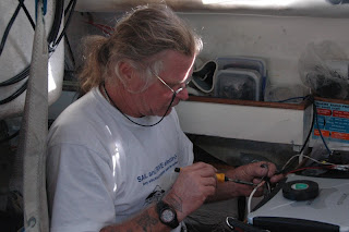
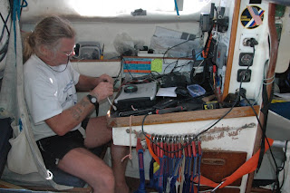
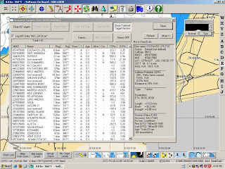
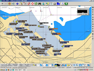

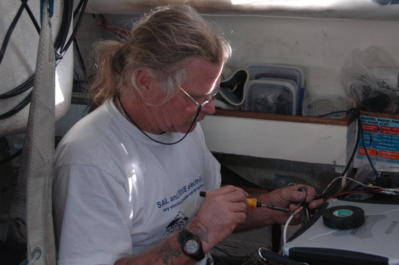
AISAutomatic Identification System. An automatic tracking system used on ships and by vessel traffic services (VTS) for identifying and locating vessels. – Automatic Identification of Ships – gizmology with attitude and relevance. Big ships (>300 DWT for the techies) are required to transmit AISAutomatic Identification System. An automatic tracking system used on ships and by vessel traffic services (VTS) for identifying and locating vessels. data on VHFVery High Frequency radio. Short range radio equipment for voice and other applications such as AISAutomatic Identification System. An automatic tracking system used on ships and by vessel traffic services (VTS) for identifying and locating vessels.. radio (Ship’s GPS position, likelihood of collision, name, MMSIMaritime Mobile Station Identity; used for radios with digital selective calling (DSC), as well as AIS (Automatic Identification System) transponders. It allows two vessels with radios that have this capability to exchange information about who they are and where they're going without need for voice contact . There is a unique numeric identifier for each user of AIS system., course, speed, destination…..lots more) and carry expensive equipment that reads, integrates and plots the data from other ships using GPS so everyone has a position for everyone else, plus a lot of other information. Us little boats can clock in with the right gizmological goodies and use the data and it’s brilliant. If it’s working! Berri’s AISAutomatic Identification System. An automatic tracking system used on ships and by vessel traffic services (VTS) for identifying and locating vessels. black box died somewhere between Lisbon and here but we now have a better and, I hope, more durable one courtesy of Udo. Pics are of Udo installing the box and two screen dumps of the data – first one shows the list of ships whose data we were receiving plus the specific data from one ship, in the right hand column. Second one has the plot of the Cape Town harbour with the ships we were receiving in their correct positions.
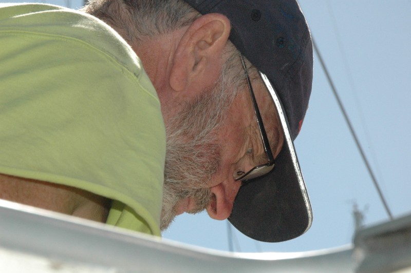
And Pete, fixing the leak over my feet at the same time.


 The logs ramblings can be cryptic, so we have added: