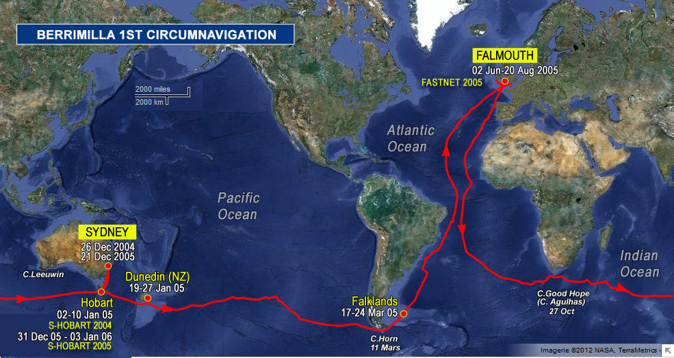
2300hrs 04 Apr 2005 UTC Map Ref 148
More idle nonsense. How many of you set off on a journey to somewhere new knowing exactly how to get there? Say from Randwick to Liverpool (in Sydney, for our foreign guest…) or from Chatswood to Burrumbuttock? (Look it up…) I was thinking about mud maps – mental plots – when I was describing our track for NASA to pass on to Leroy. He’s an astronaut and a pilot and it’s really very easy to do – we’re tracking parallel to the South American coast about five hundred miles out at about 5 knots, starting from Stanley on Saturday at noon. If there’s no need for precision, that’s all he will ever need. An instant mental map shimmies into the subconscious and at any time it would be possible to put a 20 mile circle around us as long as we keep to the plan. When I was a bit more mentally agile, I had to keep a mental plot of my aircraft moving any old where over the sea at 600 knots and again, the mud map oozes out between the mental toes both in advance and as one goes along. There are simple rules that help cut corners with mental arithmetic, but the trick all the time is to stay ahead of the aeroplane on the mental map. Same in a boat, but more slowly. Similarly, with my track description and some fairly basic geographical knowledge – say a simple Mercator projection of the world, I should be able to get from here to almost anywhere else without putting pencil to paper. Huge margin for error but conceptually at least, it is easy and it has been done. Obviously a very silly idea, but it illustrates the point.
So back to Chatswood. Do you make a plan – look at the street directory and the road atlas before you set off and work out the route and tick it off in your head as you go? Do you just assume that you can follow the signposts? Do you more or less ignore street names and just head south west? Or do you drive a Beemer with one of those dreadful GPS thingies that talks to you in lugubrious Californian dialect so you end up somewhere not knowing where you’ve been or how to get back? Or a combination of all of them? Or just get a taxi? Then transfer the whole exercise to a strange country and ask the same questions.
What the hell’s this got to do with passing Montevideo, do I hear you ask? Well everything actually. The planning for the actual navigation on this one was basically Times Atlas (currents, weather patterns etc on a very large scale), Admiralty Pilot, World Pilot Charts, Virtual Passage Planner (a software package that Mal is also using to create the website maps) to check great circle distances and the back of a smallish envelope. Depends on scale and distance – the shorter and more precise the journey the more detail that is required. For this one, the back of an envelope was fine – no major constraints or show stoppers at this time of year, about 27000 miles give or take a few at an average of 5 knots (That’s the hardest bit) gives so many hours of sailing. Will it fit into the time available? Seems it will, with a lot of luck – so it’s a goer. What do we need to do to do it? And that’s where the really hard bit starts. A lot of that stuff is on the website, particularly if you read between the lines. The navigational detail then just fills in the empty spaces more or less as we go.
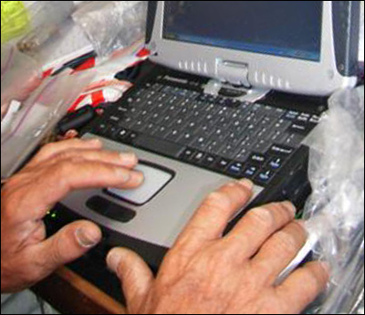
But I’d hate to be without my 5 GPS’s and Software on Board and the chunky laptop. Of all the people who might read this, the one who travels fastest and furthest is Leroy and – as far as I know, anyway, he doesn’t have to think about it at all – it’s mostly done on the ground and fed into the ISS computers and he gets to enjoy the ride. He told me tonight that they are about 350 km above the earth and I know they are traveling at about 5 miles per second. During my, for me, sluggardly marathon in Stanley, they travelled about 84,600 miles to my 26. At the time, my mudddy brain couldn’t handle the zeros in the calculation so I cheated with a calculator later. And it was me that was sore.
 The logs ramblings can be cryptic, so we have added: